When we talk about the consequences of coal mining, the first things that usually come to mind are polluted air, coal dust and emissions of harmful substances. But I want to begin deeper down—with what happens to the earth itself.
Open-pit and underground coal mining interfere with the structure of the subsurface. Rock is removed from the ground, mine workings are created, enormous masses of overburden are moved into waste dumps, and water is pumped out. The topography changes, the soil cover is disturbed, and loads and stresses in the rock are redistributed.
The subsurface of Kuzbass has a long and complex history. Coal-bearing sediments accumulated here, folds and faults formed, and magma intruded into the rock. Modern mining has entered this geological history as a new influence. To understand its possible consequences, it is not enough to look only at the amount of coal extracted.
One possible consequence of this intervention is a human-induced earthquake. Mining can change the conditions that keep rock stable and initiate movement along an already stressed fault. The focus of such an event may lie considerably deeper than the mine workings themselves.
I had known about the Bachatsky earthquake for a long time. Now I wanted to look at the question more broadly: where else has open-pit extraction of solid minerals been accompanied by strong earthquakes? How close were their foci to the pits? How did researchers establish a link with mining? And what do twenty years of observations in Kuzbass show—is seismic activity increasing, decreasing, or changing in a more complicated way than we might expect?
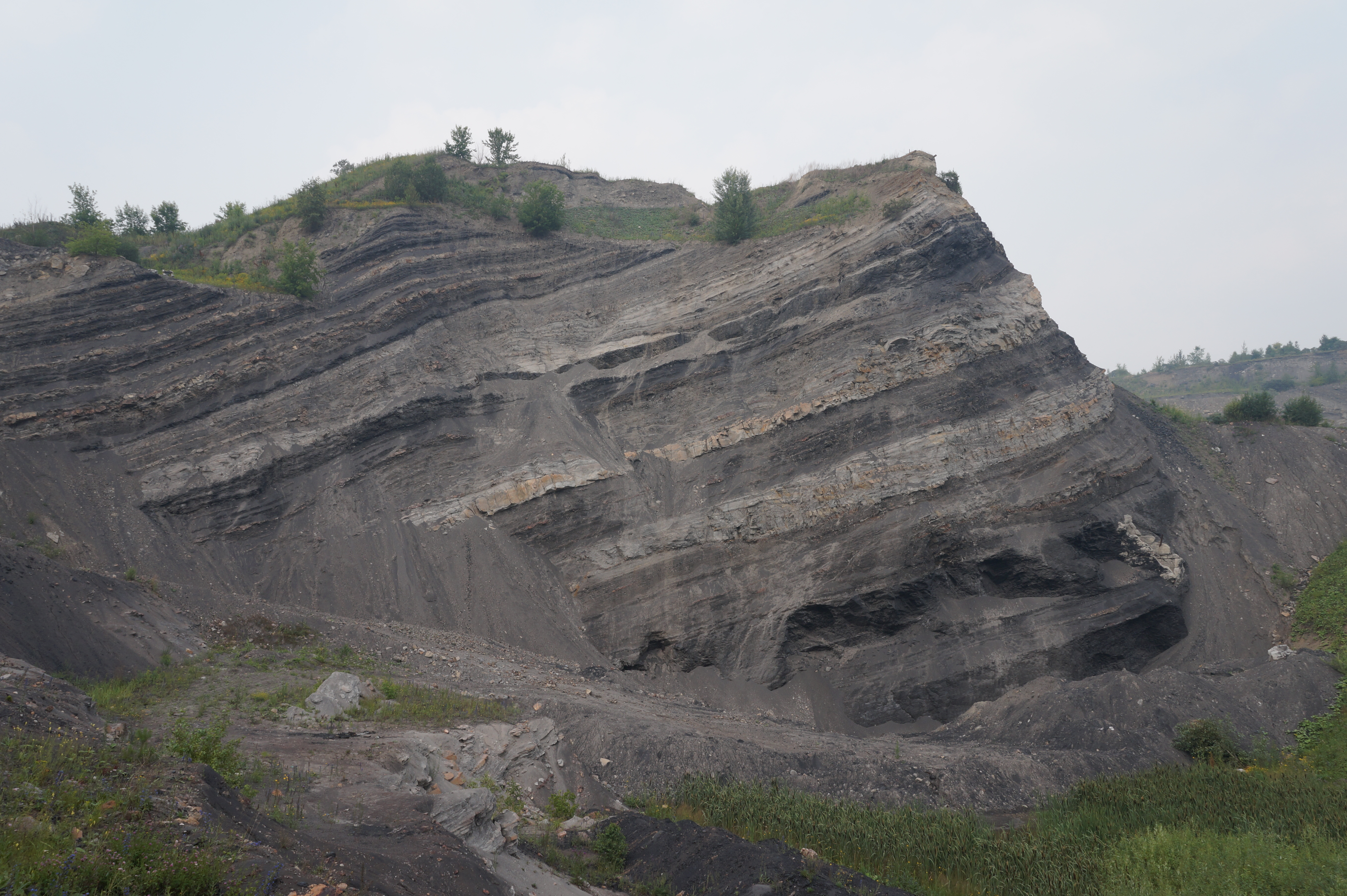
The main coal-bearing sequence of Kuzbass formed during the Carboniferous and Permian periods. It is older than the basalt bodies and sills studied here, which are approximately 250–248 million years old. Later movements of the Earth’s crust folded the rocks and cut them with faults. Modern mining therefore affects not a uniform seam, but a complex folded and faulted rock mass through which water moves and in which stresses already exist. 1 2
In one place, the coal seams and surrounding rocks are relatively even; elsewhere, they are disrupted by folds and faults. In some places water drains through fractures, while in others it is held back by layers with low permeability. An intervention that looks the same at first glance can therefore have different consequences. Assessing risk requires knowledge of the structure of the specific site, the depth and direction of mining, and the positions of faults, waste dumps and aquifers.
What Mining Changes Underground
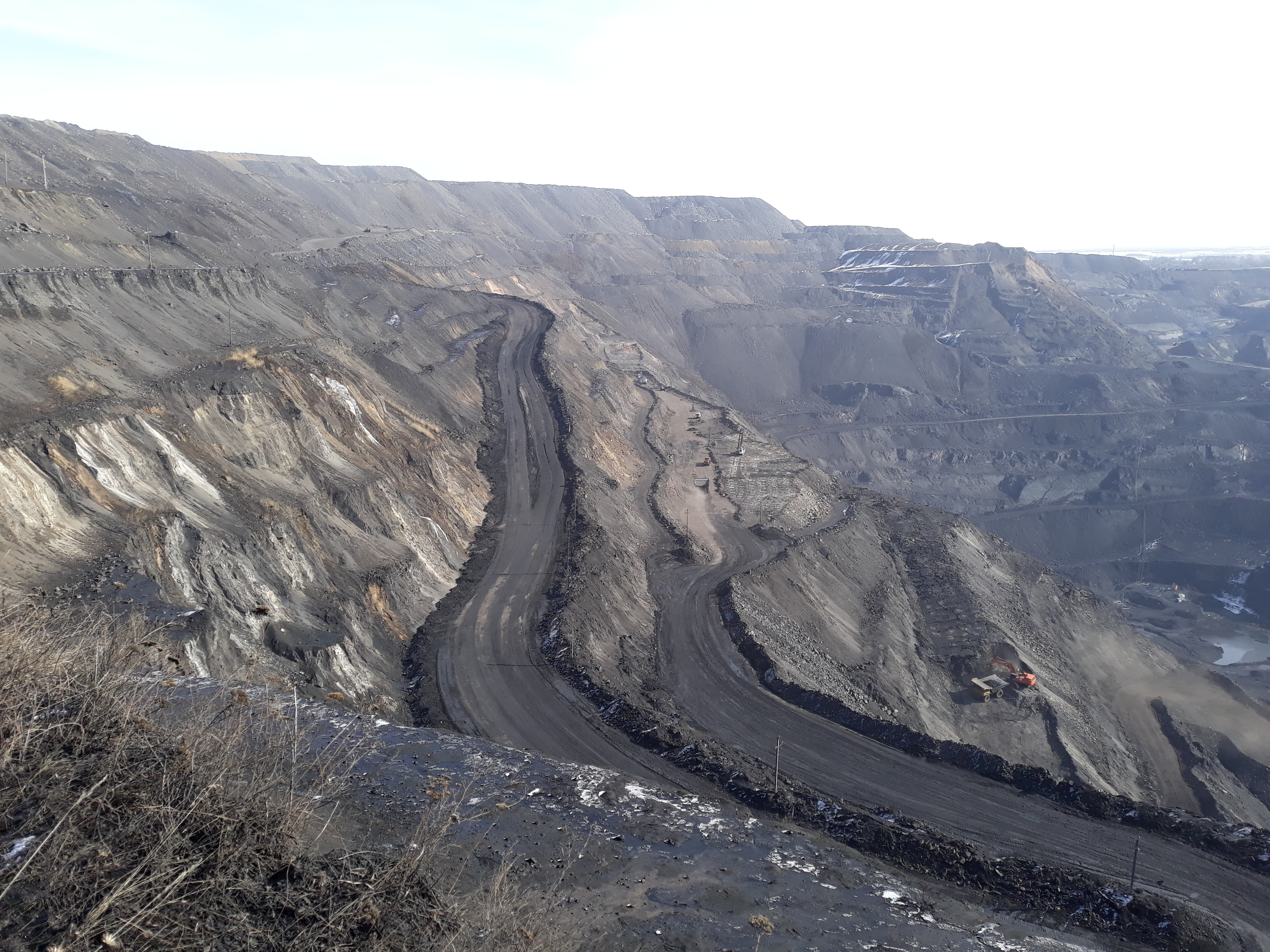
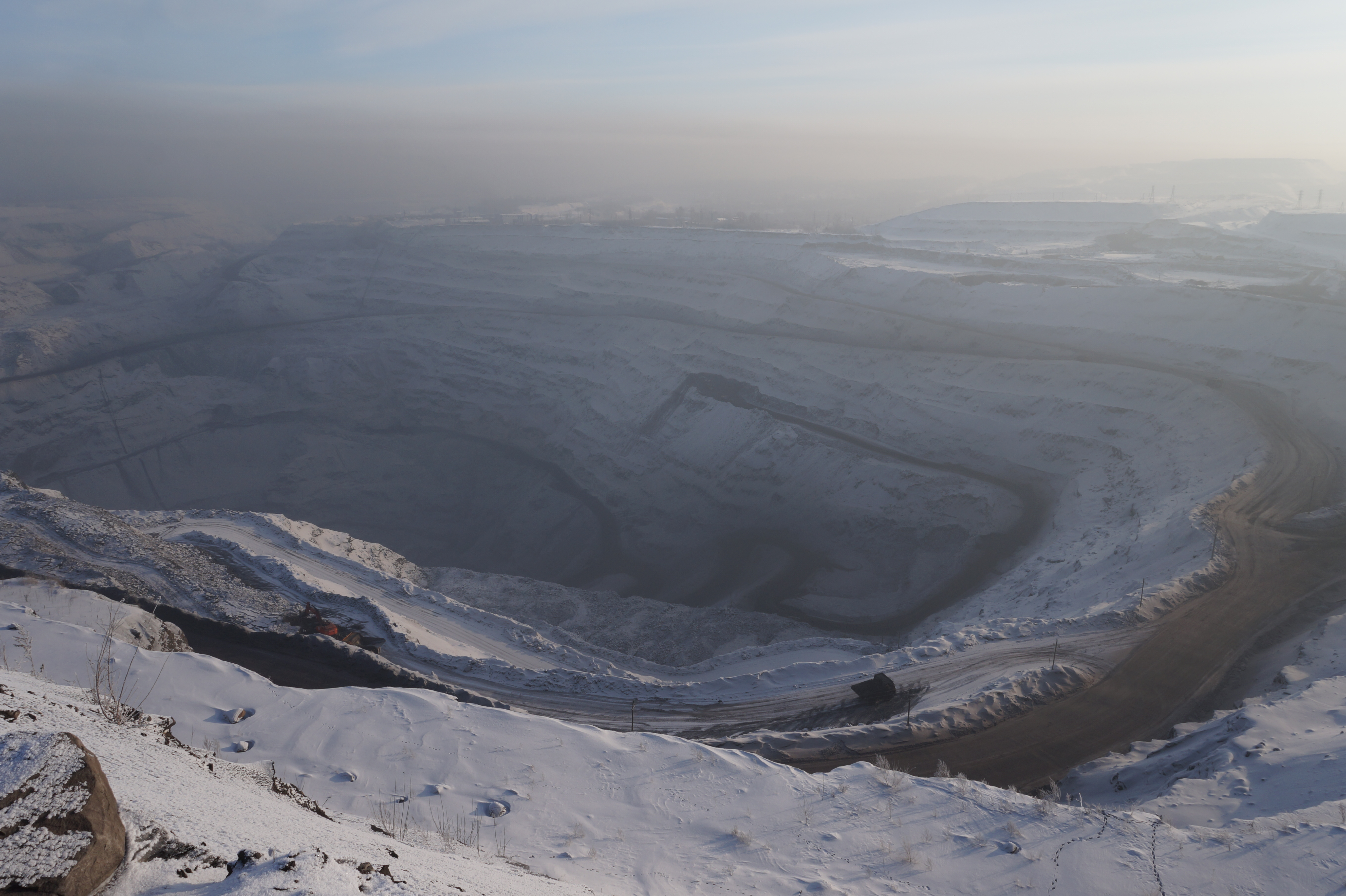
When open-pit mining begins, the soil is removed first, followed by the overburden covering the mineral deposit. A deep excavation with high walls takes the place of the previous topography. The excavated rock is placed in waste dumps—in other words, an enormous mass is moved from one area to another.
At the surface, this destroys the soil cover and the former landscape. At depth, it removes load where the pit has formed and adds load where a dump has grown. Pit walls can deform and slide. Fractures alter the paths of water. Dewatering, which is necessary for an open-pit mine to operate, lowers groundwater levels and changes pressure in the pores and fractures of the rock. When pumping stops, water returns and conditions change again.
An underground mine affects the rock differently. Excavated voids remain underground; the roof above them bends and collapses, and the surface may subside. Zones of increased stress develop ahead of a longwall face and along its edges. If the rock fails suddenly and the impact strikes a mine working, this is called a rockburst. If a void collapses, the collapse produces a seismic signal. But another process is also possible: a change in stress reaches an existing fracture or fault, and movement occurs along it.
In the latter case, mining does not have to “create” all the energy of the earthquake. Much of that energy is already stored in the stressed rock. Mining may change the conditions enough for rupture to occur earlier than it would have without human intervention. This is why the statement that “a single blast cannot cause a shock this strong” does not disprove the human-induced hypothesis. An ordinary quarry blast is indeed not equivalent to a magnitude 5 or 6 earthquake. But years of removing and relocating rock, deepening an excavation and changing the water regime can bring a much larger volume of rock closer to failure. 3 4
What Is a Human-Induced Earthquake?
The term “human-induced” is sometimes understood too literally, as if a person pressed a button and the ground immediately began to shake. In reality, several different phenomena are involved.
- An industrial blast derives its energy from an explosive charge. It is checked against blasting logs, the exact time, the air wave and the characteristics of the seismic record.
- A rockburst is the sudden failure of stressed rock in or near a mine. It is dangerous above all to people and mine workings.
- A collapse is the fall of a roof or the closure of an excavated void. This kind of source has a different movement mechanism from an ordinary shear earthquake.
- An induced or triggered earthquake is rock failure or movement along a fault after human activity has altered the load, water pressure or stresses. Some studies use “induced” for a process that probably would not have occurred without the intervention, and “triggered” for the earlier initiation of a rupture already prepared by natural stresses. In practice, the distinction is not always visible in the available data.
These events can be distinguished only through a combination of evidence. Waveforms, the ratio of P and S waves, first-motion polarities, depth, focal mechanism, the distribution of aftershocks and operational data all matter. A coincidence in time or proximity on a map is not enough.
Another distinction is important here. The epicentre is the point on the surface above the source. The hypocentre, or focus, lies underground. The map distance from the epicentre to the edge of a pit does not show the distance from the focus to an underground working or fault plane. A three-dimensional model is needed for that.
Magnitude and intensity also answer different questions. Magnitude characterises the size of the seismic source. Intensity describes how the shock manifested itself at a particular place: what people felt and what happened to buildings. In addition, ML, Mw, mbLg and other magnitude scales are calculated differently. I therefore do not treat them as interchangeable or turn five cases into a strict worldwide ranking.
Five Documented Cases Associated with Open-Pit Mining
Global databases include stronger events associated with oil and gas extraction, fluid injection or reservoir impoundment. I excluded them because I am examining interventions associated specifically with open-pit extraction of solid minerals. I also excluded events linked only to deep underground mining.
What follows is not a ranking by magnitude, but five cases from different sites, selected for the diversity of their mechanisms and the quality of their documentation. The primary studies make it possible to reconstruct at least part of the depth, the position of the focus relative to the excavation, the consequences and the basis for linking the event to open-pit mining. Wappingers Falls is weaker than some other events, but it demonstrates especially clearly the relationship between the foci, the footprint of the quarry and unloading of the rock mass.
| Date and place | Mine and mineral | Magnitude and depth | Position relative to the mine | Consequences and assessment of the link |
|---|---|---|---|---|
| 18 June 2013 UTC, Bachatsky, Russia | Bachatsky open-pit mine, hard coal | ML 6.1; about 4 km |
The focal area was associated with the mine; stronger events tended towards the pit wall, weaker ones towards the volume beneath the excavation, and increased density was also observed beneath waste dumps. No single reliable distance to the historical legal boundary was calculated | Intensity up to 7, damage to homes, chimneys and public buildings; about 5,000 aftershocks. Detailed studies classify the event as human-induced |
| 29 November 1980, Bełchatów, Poland | Bełchatów open-pit mine, lignite | Published as M 4.66; depths of about 0.5 to 5 km were discussed for the early sequence |
The event occurred in the mine area; a reliable distance to the 1980 mining boundary could not be reconstructed from open sources | Cracks and damaged chimneys were reported; studies link the sequence to unloading, groundwater drawdown and pre-existing tectonic stress, although the focal depth was interpreted differently |
| 16 January 1994, Cacoosing Valley, Pennsylvania, United States | Abandoned carbonate-rock quarry | mbLg 4.6; later recalculations about Mw 4.3–ML 4.4; aftershocks in the upper 2.5 km |
The approximately 800-metre-wide quarry lay directly above the identified rupture zone; the exact distance from the epicentre to the historical edge was not published | Intensity VI–VII, about $2 million in damage. The authors concluded that the sequence was probably triggered by unloading and rising water pressure after pumping stopped |
| 9 January 2019, Kolyvansky, Novosibirsk Region, Russia | Kolyvansky open-pit mine, anthracite | ML 4.3; about 4 km |
The epicentre was in the area of open-pit workings in the Gorlovka Basin; the paper gives no exact distance to a verified mine boundary | The shock was felt in settlements, including Novosibirsk; detailed observations led the authors to classify it as human-induced activation. No verified list of damage was found |
| 7 June 1974, Wappingers Falls, New York State, United States | Large limestone-aggregate quarry | mbLg 3.3, also ML 2.9; approximately 0.5–1.5 km |
The foci lay directly beneath the quarry—inside its surface footprint, rather than at a calculated distance from a historical boundary | Intensity VI, broken windows and other minor damage; more than 100 aftershocks in six days. The authors linked the sequence to unloading caused by quarrying |
The Bachatsky Earthquake
The main shock occurred on 18 June 2013 at 23:02:09.6 UTC—the morning of 19 June local time. A local solution placed it at approximately 54.29° N and 86.17° E, at a depth of about 4 kilometres, with ML 6.1. Intensity reached 7 in Bachatsky and Starobachaty. Official and scientific materials describe damage to homes, chimneys and public buildings. 5 7
But the strength of the shock is only one part of the evidence. A monitoring network was already operating near the open pit before the main event. Additional stations were installed afterwards, and about 5,000 aftershocks were recorded. The result was not one approximate point on a map, but a three-dimensional picture of the rupture. The long axis of the aftershock area followed the mine. Most weaker foci lay beneath the excavation, stronger events more often occurred near the pit wall, and beyond the excavation increased density was observed beneath the waste dumps.
Researchers considered several possible influences: blasting, the removal and relocation of an enormous mass of rock, changes in topography and changes in the water regime. A single blast could not explain the depth, the shear mechanism and the prolonged aftershock sequence. The cumulative effect of mining on a stressed rock mass was the most convincing explanation. A later analysis showed that mining may have brought an existing geological structure closer to failure rather than supplying all the energy of the shock itself. 6
This is why the Bachatsky case cannot be reduced to the statement that “there was an open-pit mine nearby.” Several independent lines of evidence converge here: observations before and after the main shock, shallow depth, focal mechanism, the geometry of thousands of aftershocks and the history of changes at the mine itself. The published literature describes it as the largest well-studied human-induced earthquake associated with solid-mineral extraction.
Bełchatów: Unloading Above and Water at Depth
The Bełchatów open-pit mine in Poland extracts lignite. On 29 November 1980, an event occurred in the area for which company materials report a magnitude of 4.66. An early scientific paper examined a sequence of shocks that began after open-pit operations had developed. The authors tested three possible focal levels: about half a kilometre, 3–4 kilometres and approximately 5 kilometres. This is an important example of why depth cannot be assigned from surface proximity alone.
The proposed mechanism involved several processes at once: removal of mass above the pit, groundwater pumping and stress on ancient basement structures. Later materials reported cracks in buildings and damaged chimneys during strong shocks. The link with open-pit mining is considered well founded, but the precise location of the focus and the contribution of each mechanism have been debated. 890002-8) 9
Cacoosing: The Quarry Closed, but Conditions Continued to Change
The carbonate-rock quarry in Cacoosing Valley near Reading ceased operations in December 1992. Water had been pumped out while it operated. After closure, the quarry began to fill, the water level rose, and a seismic sequence began in 1993. The main shock, mbLg 4.6, occurred on 16 January 1994; recalculations of about Mw 4.3 and ML 4.4 were also published.
A temporary network located the aftershocks in the upper 2.5 kilometres of the crust and outlined a rupture plane. The quarry lay directly above it. Calculations showed a small but physically significant change in Coulomb stress. Much of it was associated not only with the removed rock, but also with increasing pore pressure after flooding. The earthquake produced intensity VI–VII shaking and about $2 million in damage. The authors concluded that the 1993–1997 sequence was probably triggered by the quarry. 10
This case is particularly important to me. It shows that stopping extraction does not always bring geomechanical processes to an immediate halt. If the water regime changes, a new stage can begin after the operation has already closed.
Kolyvansky: Human-Induced Activation near an Anthracite Mine
The Kolyvansky open-pit mine is not in Kemerovo Region but in neighbouring Novosibirsk Region, in the Gorlovka Coal Basin. I include it in the international comparison, but not in the Kuzbass statistics. On 9 January 2019, an ML 4.3 earthquake occurred there at a depth of about 4 kilometres. It was felt in nearby settlements and in Novosibirsk.
The authors compared the event with the growth of open-pit mining and the seismic activation observed in the area, and classified it as human-induced. From the available publication, I could not reconstruct the exact distance from the epicentre to the historical boundary of the excavation or a complete register of damage. I therefore preserve the researchers’ classification without adding precision that does not exist. 11
Wappingers Falls: A Smaller but Revealing Case
The Wappingers Falls event was weaker than the others in the table: mbLg 3.3, and ML 2.9 on the local scale. It occurred on 7 June 1974 at 19:45:37 UTC. The foci lay at depths of approximately 0.5–1.5 kilometres directly beneath a large limestone-aggregate quarry. More than one hundred aftershocks were recorded during the six days following the main shock. Intensity reached VI; broken windows and minor damage were reported.
The case became part of a classic study of earthquakes triggered by surface quarrying. It clearly illustrates the principle: removing tens of millions of cubic metres of rock can reduce normal pressure on an already stressed structure beneath a quarry. 12 13
What Happened in Kuzbass over the Past Twenty Years
For this study, I compiled records from 10 October 2006 to 10 October 2026 from the annual catalogues of the Geophysical Survey of the Russian Academy of Sciences and operational event cards from recent years. The combined series contains 4,977 records classified by the sources as earthquakes. But I do not call them 4,977 human-induced earthquakes.
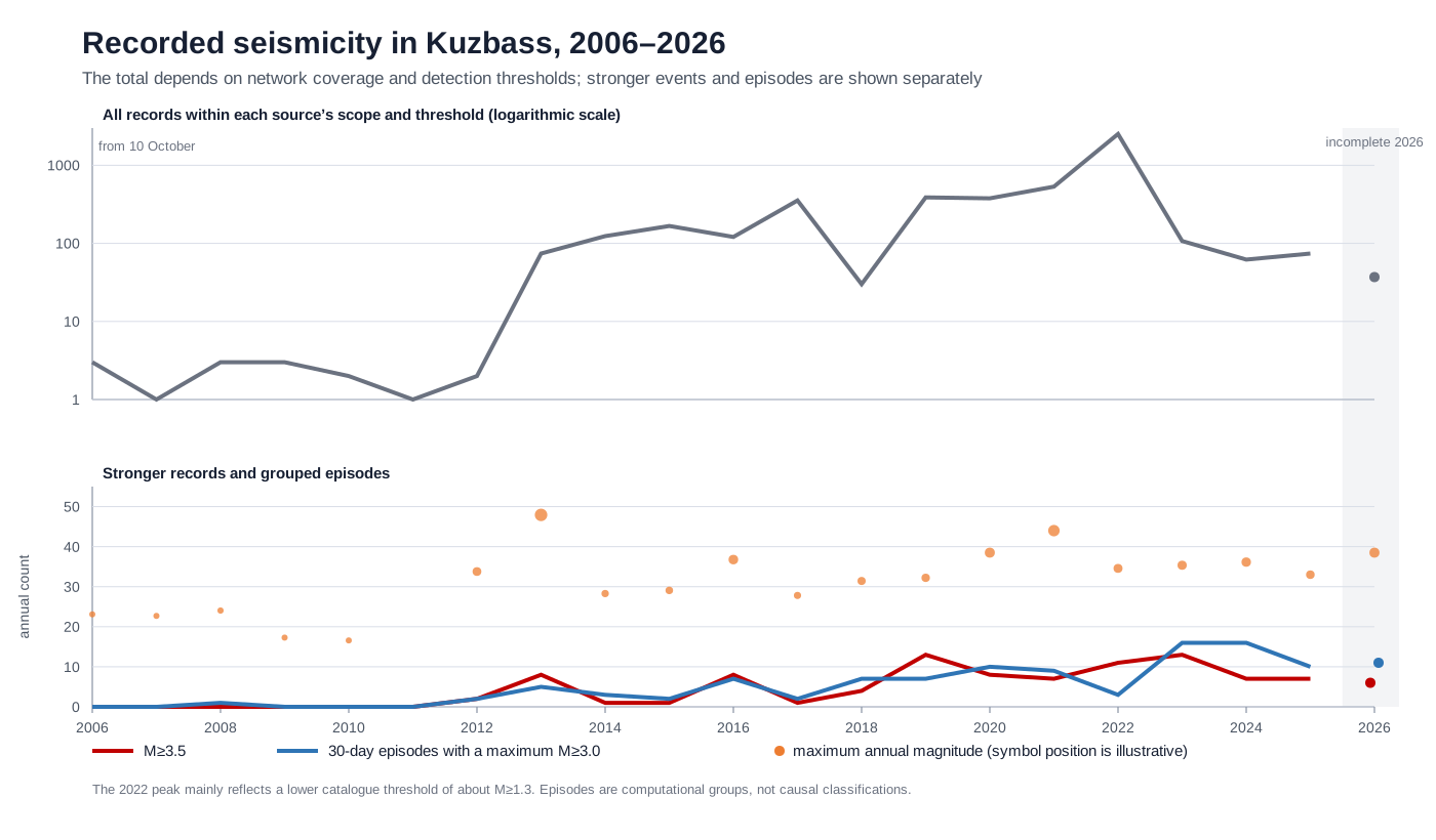
First, an earthquake catalogue reports the type of seismic signal, not necessarily its cause. Second, the completeness of observation changed substantially. The lowest published magnitude in the annual lists used was approximately M 1.9 in 2020, M 1.7 in 2021, M 1.3 in 2022 and M 2.4 in 2023. These are not proven catalogue completeness thresholds, but simply the lowest values present in the available publications. Even so, their variation, together with changes in network density, shows why counts of weak recorded shocks cannot be compared mechanically.
This is why 533 records in 2021, 2,514 in 2022 and 107 in 2023 do not mean that the number of earthquakes increased almost fivefold in one year and then fell twenty-threefold. A large part of the jump was created by the recording methodology. Operational data for 2025–2026 are also not equivalent to a final reviewed catalogue. 15 16
There is another reason not to add up every row. A strong event is followed by aftershocks; in a swarm, dozens or hundreds of shocks may form part of a single activation episode. The approximately 5,000 Bachatsky aftershocks come from a detailed local catalogue compiled with a denser network after the main shock. The regional sample of 4,977 records covers all of Kuzbass over twenty years and combines annual catalogues and operational event cards with different publication rules and different levels of detection for weak events. These figures are therefore not expected to match, and they do not contradict one another. Thousands of weak Bachatsky aftershocks are not included row by row in the regional series. In the working analysis, I counted calendar records and episodes separately, grouping events that were close in time and space.
The series does not establish a single twenty-year trend—a sustained increase or a sustained decrease in seismicity. The early years are less completely recorded, the network and publication rules changed, and strong aftershock sequences sharply increase the number of records in particular years. What can be shown with confidence are distinct periods of activation: Bachatsky in 2012–2014, Kaltan–Alardinskaya from late 2016, several simultaneously active zones in 2019–2023, and repeated events in the Krasnobrodsky–Kiselevsk zone in 2023–2026.
- In 2012–2014, the Bachatsky zone dominated: foreshocks, the
ML 6.1main shock and a prolonged aftershock sequence. - From late 2016, the Kaltan–Alardinskaya zone intensified. A temporary network distinguished stronger events near the open-pit workings and waste dump from a weaker group above the underground workings of the Alardinskaya mine. The researchers classified this activation as human-induced. 17
- In 2019–2023, notable clusters appeared near the Raspadskaya mine, the Taldinsky open-pit mine, the Bachatsky and Krasnobrodsky open-pit mines, and iron-ore operations in Mountain Shoria. Coal and ore enterprises must not be conflated here.
- Three events in the Krasnobrodsky zone—11 January, 26 February and 17 October 2020, with
ML 4.1,3.9and4.9—are explicitly described as human-induced earthquakes in the official annual catalogue. - The earthquake near the Taldinsky open-pit mine on 12 August 2021 UTC had
ML 5.6and a depth of 3 kilometres. A public explanation described it as natural, while also linking the accumulation of energy to blasting by several enterprises. Without a separate analysis of the mechanism, the event remains disputed rather than proven to be either natural or human-induced. - In the Krasnobrodsky–Kiselevsk zone, notable shocks recurred in 2023, 2024, 2025 and 2026. Recurrence strengthens the case for investigation, but it does not automatically extend the classification of the 2020 events to all later ones.
Seven broad analytical zones around recurring industrial clusters contain about 82 per cent of the records in the combined series. This is a strong spatial overlap with mining geography. But I do not turn 82 per cent into “the proportion of human-induced earthquakes”: the zone boundaries were selected after reviewing the clusters and are wider than the actual boundaries of the enterprises.
Detailed cases are more persuasive than circles on a map. In the Bachatsky zone, the three-dimensional distribution of aftershocks was related to the mine geometry: many weaker foci lay beneath the excavation, stronger events tended towards the pit wall, and increased density was also observed beneath the waste dumps. In the Kaltan zone, a local network distinguished signals from open-pit and underground workings. In the Krasnobrodsky catalogue, earthquakes and more than one thousand industrial blasts were classified separately. This is how proximity becomes part of the evidence rather than a substitute for it.
What Is Known About the Event of 10 October 2026
The principal operational event card from the Altai–Sayan Branch of the Geophysical Survey of the Russian Academy of Sciences reports: 10 October 2026, 00:47:01.75 UTC, coordinates 54.09° N and 86.54° E, magnitude 4.9 and calculated intensity 6.2 on the MSK-64 scale. The card does not specify the magnitude type or depth. Other services published different coordinates and depths. According to the Ministry of Emergency Situations, there were no deaths, injuries or identified damage. 18 19
Two figures were obtained from the principal location that can easily look contradictory: approximately 1 kilometre and 9.6 kilometres. But they are distances to different boundaries. The exact calculated values are preserved in the research appendix.
The first was calculated to the broad landuse=quarry polygon in OpenStreetMap labelled as the Krasnobrodsky coal mine. This boundary represents quarry or industrially disturbed land mapped by contributors; it is not a legal boundary. The second was calculated to the Krasnobrodsky field boundary published by Global Energy Monitor. The project states that such boundaries are compiled from public information about deposits and licences, but I do not treat this polygon as a verified official cadastral boundary. It has a different geometry and purpose. 20 21
The approximately 1- and 9.6-kilometre figures are therefore not two equivalent estimates of the distance to the same pit wall. They answer different questions. Additional operational solutions move the epicentre and give distances of approximately 3–7 kilometres to the broad quarry boundary. A precise distance can be calculated only after the coordinates have been reviewed and official boundaries of the active workings have been obtained.
My working conclusion as of 10 October 2026 is this: mining may have been the cause or one of the factors behind the event. Its proximity to the Krasnobrodsky mine, repeated activations in the same zone and three previously classified human-induced earthquakes make the hypothesis a serious one. But the origin of the event has not yet been established. Testing it requires a reviewed depth, focal mechanism, waveforms, aftershocks, blasting logs, the positions of active faces, waste dumps and old workings, dewatering data and a geomechanical model.
Kiselevsk among Nine Open Pits: What Risks Do Residents Face?
The possibility of a strong induced earthquake requires assessment. The collected data do not allow its probability to be determined or justify a claim that an event on the scale of Bachatsky will occur in Kiselevsk.
There are grounds for taking the question seriously. For decades, Kiselevsk has experienced the combined influence of open excavations, large waste dumps, old underground workings, mass blasting and dewatering. Shallow-focus events up to ML 4.9 have already occurred within several kilometres of the city’s administrative boundary, and three events in 2020 were explicitly classified as human-induced earthquakes in the official catalogue. This broad zone became active again in 2023–2026, although the origin of each later event has not yet been established.
But large pits and waste dumps alone are not enough to produce an earthquake like the ML 6.1 Bachatsky event. There must be a geological structure capable of a rupture of the corresponding size, a stress state close to rock strength, and an industrial change in loads or the water regime sufficient to initiate movement. I found no open three-dimensional model of faults, mining operations and stresses in Kiselevsk among the materials examined.
Nine Open-Pit Excavations Remain in the City
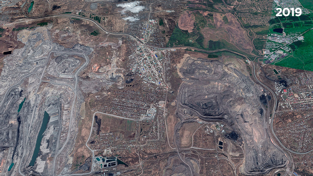
When I refer to nine open pits in Kiselevsk, I mean nine physical excavations remaining in the urban landscape. This is not the number of companies operating today. An enterprise may cease operations, change owners or disappear as a legal entity, but the pit does not fill itself in. The altered walls and ground, waste dumps, disturbed water regime and the need to monitor the stability of land near homes and infrastructure remain with it.
Open sources do not provide a single named geographical register that would reliably match each of the nine physical excavations with an enterprise, licence and current status. A 2013 municipal programme reported two underground mines and seven open-pit mines. An official health profile using 2019 data listed nine coal-mining enterprises in Kiselevsk Urban Okrug, and an industry magazine in 2020 referred to the same set as nine operating open-pit mines. These are historical snapshots, not proof that nine open-pit mines were operating in 2026, and not a named map of the nine excavations. 27 28 29
Satellite images show large excavations and waste dumps among residential neighbourhoods. A project site map for Shakhta No. 12 LLC shows licensed areas, open-pit workings, industrial sites, reclamation areas and residential development in Kiselevsk within one frame. For one specific site, the explanatory text places the nearest homes approximately 300 metres to the north and 450 metres to the west. These distances cannot be generalised to the entire city, but they document the kind of proximity involved: an industrial site and homes exist within the same urban fabric. 30 31
What Has Already Happened in the Immediate Area
The combined catalogue for 10 October 2006 to 10 October 2026 contains 45 records inside the administrative boundary of Kiselevsk Urban Okrug and within five kilometres outside it. This is the total: seven events within the okrug and 38 in the outer five-kilometre band. Of all 45 records, 24 have a published magnitude of at least 2.5, 13 of at least 3.0 and seven of at least 3.5. The records include sequences and do not represent 45 independent activation episodes.
For regional context, the table below also includes the events of 11 January 2020 and 2 September 2023, both of which lay outside the five-kilometre band. They are not included in the total of 45 records given above.
| Date | Published parameters | Distance to the boundary of Kiselevsk Urban Okrug | What is known about the origin |
|---|---|---|---|
| 11 January 2020 | ML 4.1, depth 6 km |
about 9.8 km; outside the five-kilometre zone | official catalogue: human-induced earthquake |
| 26 February 2020 | ML 3.9, depth 1 km |
about 4.2 km | official catalogue: human-induced earthquake |
| 17 October 2020 | ML 4.9, depth 4 km |
about 1.7 km | official catalogue: human-induced earthquake |
| 28 March 2023 | ML 4.5, depth 1 km |
about 2.4 km | origin not specified in the catalogue; intensity 3 recorded in Kiselevsk |
| 2 September 2023 | ML 4.2, depth 1 km |
about 9.2 km; outside the five-kilometre zone | origin not specified in the catalogue |
| 10 October 2026 | operational M 4.9; depth not specified in the principal card |
about 1.3 km for the solution of the Altai–Sayan Branch of the Geophysical Survey of the Russian Academy of Sciences | origin not yet established |
The administrative boundary serves here only as a reproducible reference. It is not a boundary of industrial influence. Some mining sites connected with life in Kiselevsk cross municipal borders or lie close to them. The next calculation should therefore use dated boundaries of excavations, waste dumps and underground mine fields.
The compiled catalogues contain 4,611 records classified as industrial blasts within Kiselevsk Urban Okrug and up to five kilometres outside it. This number includes 2,991 records within the okrug and 1,620 in the outer band. The series is incomplete and is not equal to the actual number of all blasts. Its principal purpose is to keep blast signals separate from earthquakes. Tables of events and blasts, the historical list of enterprises and open mapping objects are published in the research archive. 32
Maximum Magnitude Is Not the Only Risk to Residents
Even if an event does not reach the scale of Bachatsky, Kiselevsk could sustain significant damage at a lower magnitude because of a shallow focus, short distance and the vulnerability of a particular place. Old wooden and brick houses, buildings on undermined land, excavation walls and steep slopes, the stability of waste dumps, old sinkholes, water mains, roads, power lines, schools and hospitals all require separate assessment.
Seismic risk is not just the probability of a shock. It depends on the strength of the impact, the presence of people and the vulnerability of buildings and land. In Kiselevsk, homes stand within an industrially altered landscape, making the last two components especially important.
The proximity of excavations, waste dumps, industrial sites and housing is documented. Individual human-induced events in the broad Kiselevsk–Krasnobrodsky zone are also documented. But these data do not establish which homes have already been damaged specifically by seismicity, do not prove that every waste dump or slope is unstable, and do not mean that infrastructure will inevitably be destroyed. These hazards must be tested through surveys of the ground, buildings and networks.
What Needs to Be Examined
The city needs a local network of several seismic stations capable of distinguishing weak earthquakes from blasts and refining focal depths. A single dated model should include the advance of open-pit workings, the depth and volume of excavations, the mass and height of waste dumps, old underground workings, dewatering and flooding, blasting logs, faults, buildings and infrastructure.
The Bachatsky earthquake confirms the mechanism of strong induced seismicity associated with open-pit mining in Kuzbass. But the possibility of an event of exactly ML 6.1 in Kiselevsk has not been established by the data presented here. Neither its probability nor the maximum expected magnitude has been established. The absence of these data cannot be turned into proof that the city is safe.
Investment, Coal Production and Earthquakes
I wanted to test a simple hypothesis: when more money was invested in the coal industry, mining operations expanded and more coal was produced, did the number of earthquakes increase?
Since 2006, coal production in Kuzbass rose from approximately 174 million tonnes to a peak of about 256 million tonnes in 2018, then fell to about 192 million tonnes in 2025. I compared investment both in current roubles and after an approximate conversion to 2025 prices. The conversion used a chained price index derived from the nominal change in total fixed-capital investment in Kuzbass and Rosstat’s regional index of its physical volume. This is an approximation: the compiled series contains no continuous industry deflator for coal mining. 22 25 26
In nominal roubles, industry investment and production in the same year showed a moderate association: Spearman’s rank correlation coefficient was ρ = 0.570. After investment was converted into comparable 2025 prices, however, the association virtually disappeared: ρ = 0.014. Both calculations contained 18 pairs of annual observations; industry investment data were missing for 2021, 2025 and the incomplete year 2026. Testing lags of one, two and three years produced no stable result.
The relationship with seismicity is more complicated still. For 2012–2025, including all 14 annual pairs, the association between production and the number of events with M ≥ 3.5 was almost zero: ρ = 0.085. Excluding 2013, with its exceptional Bachatsky sequence, and 2022, with its methodological jump in the catalogue, was one robustness check rather than the primary result; the remaining 12 pairs gave ρ = 0.110. For the full 2007–2025 series, the coefficient was higher—ρ = 0.626 for 19 pairs—but this result is particularly sensitive to changes in the network and differences between the early and later parts of the series. The sign and strength of the relationship changed depending on the period, threshold and method used to count swarms.
Does this mean that mining does not cause individual earthquakes? No. Regional statistics are too coarse for that conclusion. Tonnage does not show where a pit wall was deepened, how much overburden was removed, which waste dump grew, how far an underground longwall face advanced or how dewatering changed. Money may be spent on a new mine, equipment, safety, treatment facilities or maintaining an old operation—the geomechanical meaning of those investments is different.
The Krasnobrodsky area is revealing. Regional production declined after 2018, yet three events officially described as human-induced occurred there in 2020, and activation recurred in 2023–2026. This does not support a simple relationship in which “fewer tonnes today” immediately means “fewer shocks today.” Regional production and local events exist at different spatial scales: a specific rock mass may respond to the history of mining, changes in water and accumulated stress redistribution.
I did not find a stable simple relationship between real investment, annual production and the number of events in the selected magnitude range. But this result does not cancel the local evidence from the Bachatsky and Kaltan–Alardinskaya cases. It shows something else: causes must be sought at the level of a specific operation and a specific focus, not in one regional figure. The detailed annual table, calculations and three charts are published in the open research appendix accompanying this article.
What Remains at the Surface and What May Change in the Air
An earthquake ends in seconds, but its consequences depend on where the focus is located and what lies above it.
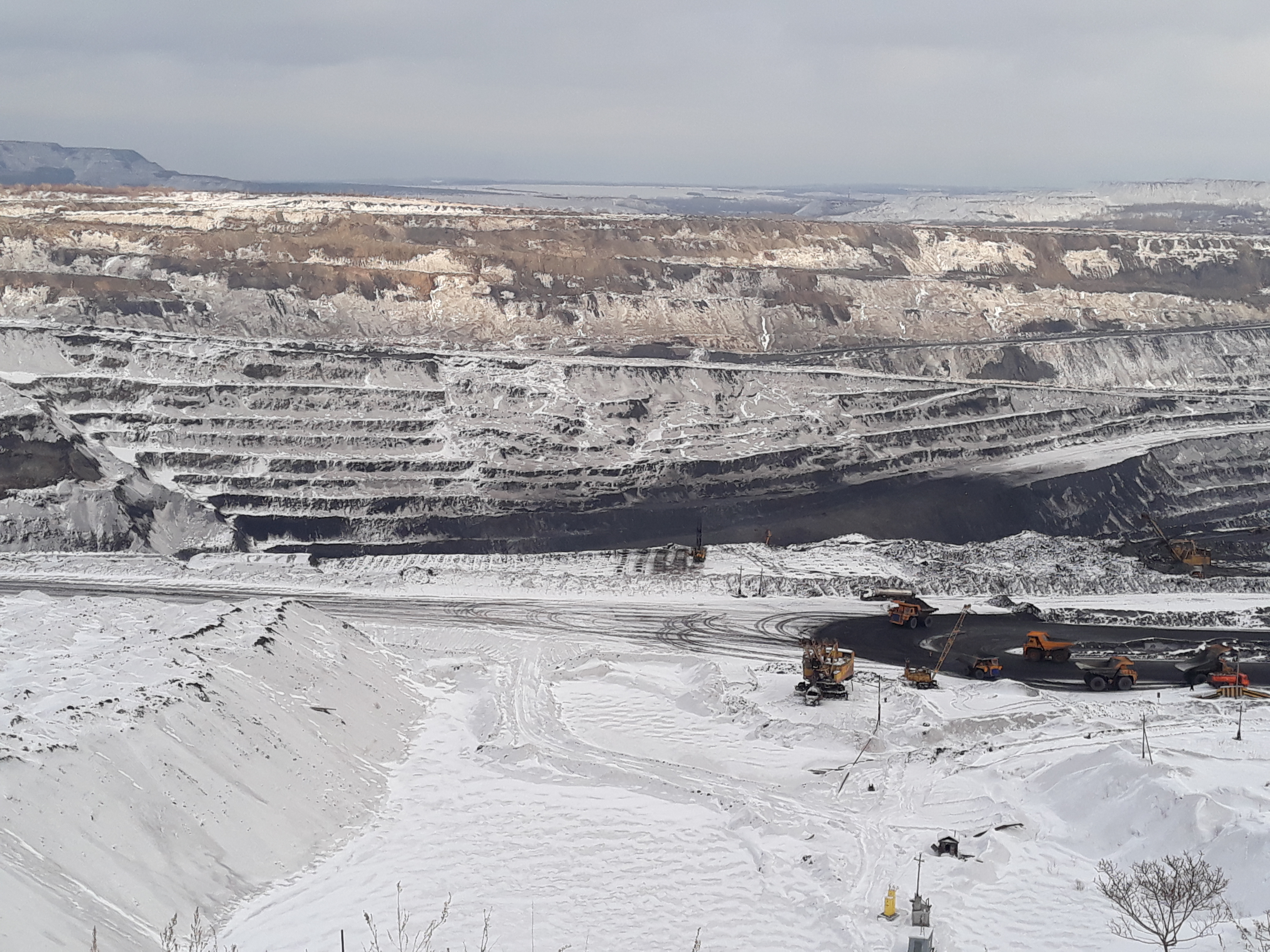
At Bachatsky, homes, chimneys and public buildings were damaged. In Osinniki and Polysaevo, repeated weak shocks damaged residential structures. Mining and seismic events may be accompanied by cracks and surface subsidence, deformation of pit walls and waste dumps, landslides and changes in groundwater pathways. Underground mines face the risks of damaged workings, rockbursts and sudden inflows of water or gas. But not every landslide, crack or change in a stream can be attributed to an earthquake: some consequences are created by mining and dewatering themselves before any perceptible shock occurs.
The connection with climate also requires precision. Coal mines, open pits and closed mines emit methane, a powerful greenhouse gas. This is a separate consequence of coal mining. A seismic rupture or rock failure may alter fracturing and permeability in the coal-bearing rock mass and therefore change gas movement for a time. Studies in underground mines have observed unusual changes in methane release after natural and mining-related shocks; models link these changes to altered permeability. 23
But I found no measured volume of additional methane emissions for either the Bachatsky earthquake or the event of 10 October 2026. Magnitude therefore cannot be converted into tonnes of gas, nor can a calculated climate footprint be attributed to these shocks. Testing this would require continuous methane measurements before and after an event—in mine ventilation, drainage systems, boreholes and at the surface—together with data on pressure and changes in fracturing.
Three things must be kept separate: routine methane emissions from mining, a possible short-lived seismic pulse, and emissions from the subsequent combustion of coal. These are different processes. International guidance requires methane from active and abandoned mines to be accounted for and states directly that reliable management is impossible without measurement. 24
The Earth Is Not Obliged to Remain Silent
Across twenty years, I did not see a simple line in which every new year brought more earthquakes. I saw something else: a sparse and incomplete early series, the Bachatsky sequence, then the Kaltan–Alardinskaya activation, several zones operating at the same time, and repeated shocks near Kiselevsk and Krasnobrodsky. Some events have been examined in detail and recognised as human-induced. Some remain disputed. For many, we have only coordinates and magnitude.
This uncertainty cannot justify inaction. If the origin of a shock has not yet been established, that means it needs to be measured—not forgotten. Residents need open, reviewed focal parameters, maps of active and old workings, blasting and dewatering data, the results of building surveys, and a functioning local network after a strong event.
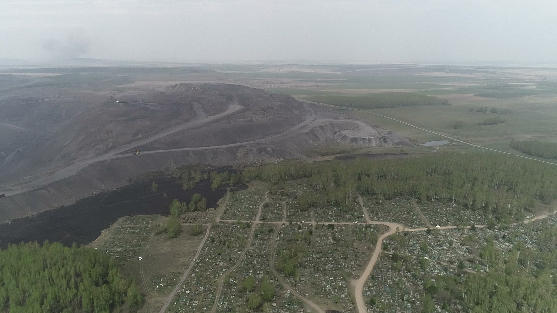
The most important lesson from international experience is that mining can trigger an earthquake not only during a blast and not only while an enterprise is operating at full capacity. Cumulative unloading, waste dumps, the position of a fault and changes in water all matter. At Cacoosing, the strongest event in the sequence occurred after the quarry had closed and flooded. At Bachatsky, thousands of aftershocks revealed the relationship with the geometry of the mine. At Bełchatów, researchers discussed unloading, groundwater drawdown and ancient structures together.
I am not predicting an inevitable disaster. But we can no longer treat the earth as an immobile foundation that can be endlessly taken apart and reassembled without a response.
The event of 10 October 2026 has not yet received a causal assessment. Future analysis may strengthen the human-induced hypothesis. It may find a more convincing natural explanation. What matters to me is that this analysis takes place and that the basis for it is accessible to the people who live nearby.
We are used to calculating the price of coal in tonnes, roubles and jobs. But if mining changes not only the air, water and surface, but the stress state of the subsurface itself, that price must include monitoring, warning, building safety and responsibility for the consequences—including after the coal has already been taken away.
Sources and Research Materials
Open the full list of sources
- Cocks et al. Deposition in the Kuznetsk Basin, Siberia: Insights into the Permian–Triassic transition and the Mesozoic evolution of Central Asia.
- Buslov et al. Permo-Triassic plume magmatism of the Kuznetsk Basin, Central Asia: geology, geochronology, and geochemistry.
- Foulger et al. Global review of human-induced earthquakes.
- McGarr, Simpson, Seeber. Case Histories of Induced and Triggered Seismicity.
- Emanov et al. The Technogenic Bachatsky Earthquake of 18 June 2013.
- Kocharyan et al. Potential triggers for large earthquakes in open-pit mines: A case study from Kuzbass.
- Russian Ministry of Emergency Situations in Kemerovo Region: recollections of the response to the Bachatsky earthquake.
- Gibowicz et al. Seismicity induced by surface mining: the Bełchatów, Poland, earthquake of 29 November 1980.
- Ground Displacement and Seismic Risk in a Brown Coal Mine: summary table of strong events at Bełchatów.
- Seeber et al. The 1994 Cacoosing Valley earthquakes near Reading, Pennsylvania.
- Emanov et al. The Kolyvansky Earthquake of 9 January 2019, ML 4.3.
- Pomeroy, Simpson, Sbar. Earthquakes triggered by surface quarrying—the Wappingers Falls sequence.
- USGS Geological Survey Circular 723-B: parameters and consequences of the Wappingers Falls event.
- Yakovlev, Lazarevich, Tsirel. Natural and Induced Seismic Activity in Kuzbass.
- Geophysical Survey of the Russian Academy of Sciences, “Earthquakes of Russia” database.
- Shevkunova et al. Detailed catalogue of 2024 seismic events near monitored mining operations.
- Emanov et al. Monitoring seismic activation in the area of the Kaltansky open-pit mine and the Alardinskaya underground mine.
- Operational event card for 10 October 2026, Altai–Sayan Branch of the Geophysical Survey of the Russian Academy of Sciences.
- Russian Ministry of Emergency Situations in Kemerovo Region: updated information on the consequences of the event of 10 October 2026.
- Global Energy Monitor: Krasnobrodsky coal mine.
- OpenStreetMap: broad mapped boundary of the Krasnobrodsky open-pit mine.
- Kemerovostat: Kuzbass in 2025.
- Qi et al. Modelling and simulation of earthquake-induced changes in methane emission from an underground coal mine.
- UNECE: guidance on measuring and reducing coal-mine methane emissions.
- 2013 State Report on the Environment of Kemerovo Region: historical coal-production series.
- 2019 State Report on the Environment of Kemerovo Region.
- Health profile of residents of Kiselevsk Urban Okrug, p. 55.
- Kiselevsk municipal administration Resolution No. 221-n of 10 June 2013.
- Ugol Kuzbassa magazine: “Mining Towns”, May–June 2020.
- Environmental impact assessment materials for Shakhta No. 12 LLC, including a site map.
- Greenpeace España: satellite comparison of Kiselevsk in 2004 and 2019.
- Open archive of the study’s data, maps and calculations.
Detailed calculations for the twenty-year series, episode-grouping rules, object geometry, cards for key events, the economic test and the annual table are published in the full research PDF and the open data archive accompanying the article.