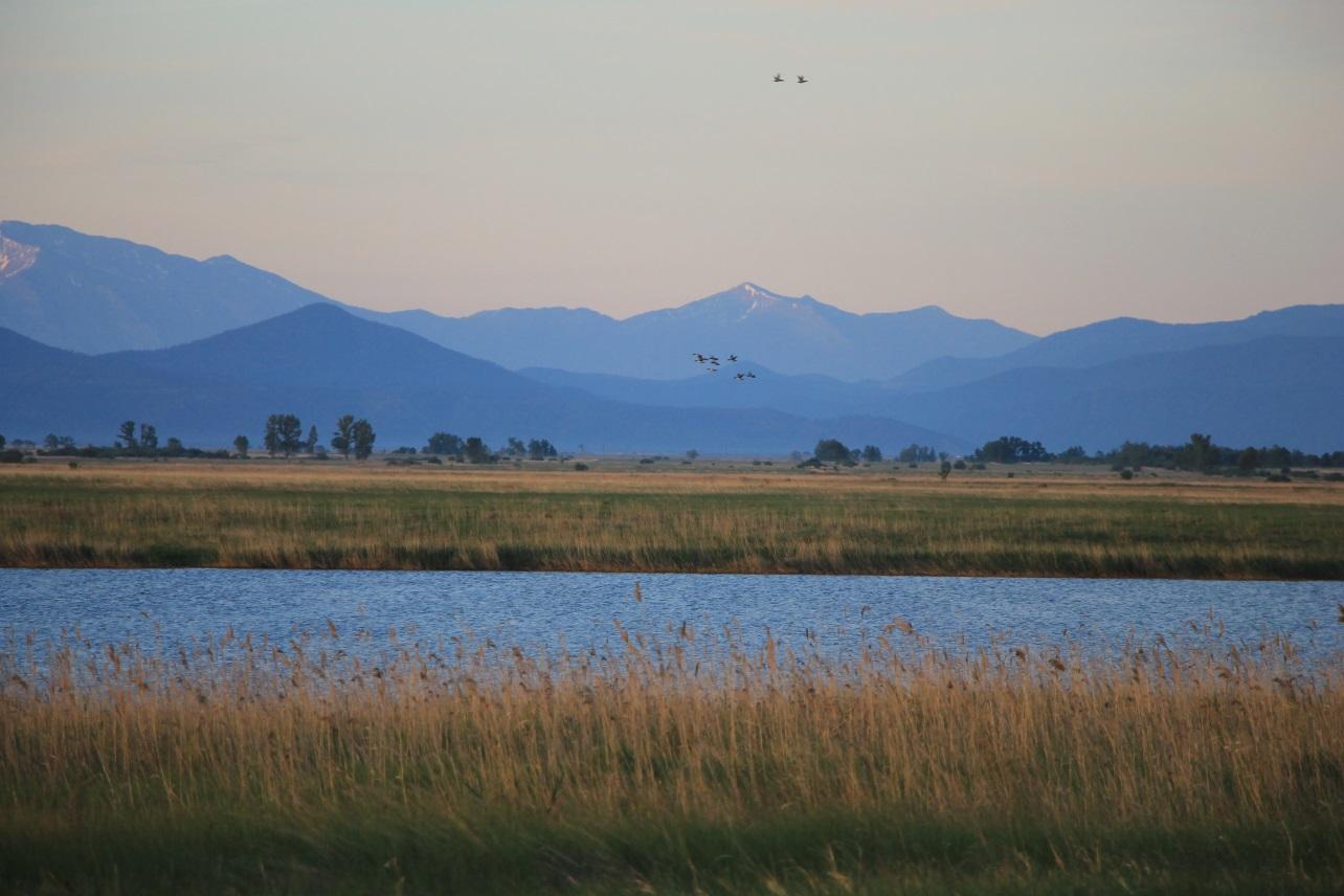
The Koibal Steppe is my homeland. Between the Abakan and the Yenisei, dry steppe, lakes, marshy meadows and reed beds exist side by side. The value of this place lies in the way they are connected. Water sustains the lakes and wet depressions; plants provide shelter and food; birds find places to nest and rest on their long journeys.
At the centre of the steppe lies the Sorokaozyorki tract, an ancient channel of the Yenisei with a chain of small bodies of water. In a 2015 study, ornithologists Tatyana Geld and Tamara Zlotnikova recorded more than one hundred bird species here, including 28 species listed in Red Data Books at various levels. The tract was one of the key breeding sites in Khakassia for the demoiselle crane, Eurasian bittern and bearded reedling.18
The authors reported that Sorokaozyorki was included on the “shadow”, or prospective, list of wetlands under the Ramsar Convention. This means that the tract was regarded as a candidate for international status, not that it already held that status.18
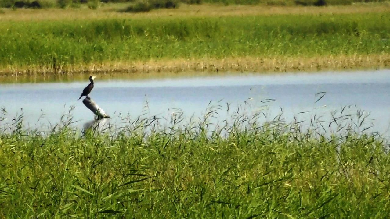
The lakes are home to ruddy shelducks, mallards, Eurasian coots, grebes and grey herons. Rare birds recorded there include the swan goose, Bewick’s swan and Baillon’s crake. Steppe polecats, European hares, badgers and muskrats live in the surrounding habitats. Behind every name is a particular need for water, food, shelter and space.19
 Enlarge ↗
In 2020, the Lakes of the Koibal Steppe protected area was established here as a regional wildlife sanctuary (zakaznik). It includes Lakes Ptichye, Sobachye and Zalivnoye, small temporary bodies of water, sections of irrigation canals, marshy meadows and areas of steppe covering a total of 1,261 hectares.1920 This is not the whole Koibal Steppe or the whole Sorokaozyorki tract, but a specific protected area within this natural system.
Khakass State University, which helped prepare the sanctuary, explained the choice of territory in very clear terms: it included three Sorokaozyorki lakes that, when the sanctuary was established, lay outside the land allotments of coal-mining companies — Ptichye, Sobachye and Zalivnoye.20
For me, those words capture the cost of what is happening. Coal licences and land allotments appeared on territory where life already existed. Now the ground is being opened and groundwater pumped out for coal extraction, changing the system on which the lakes, pastures, animals and people depend.
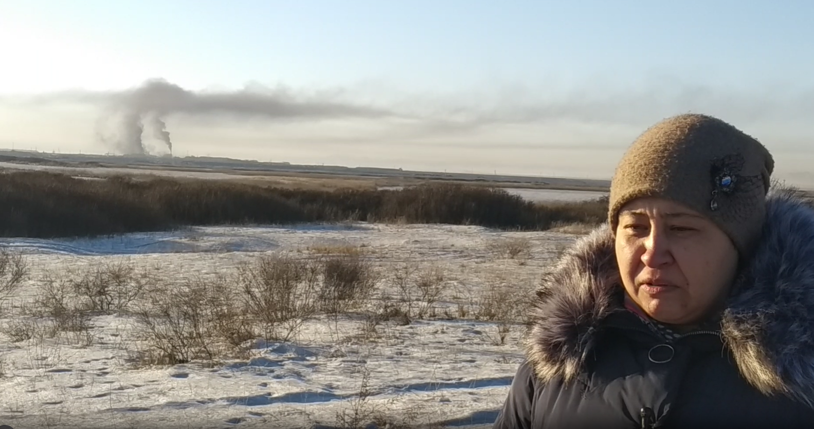
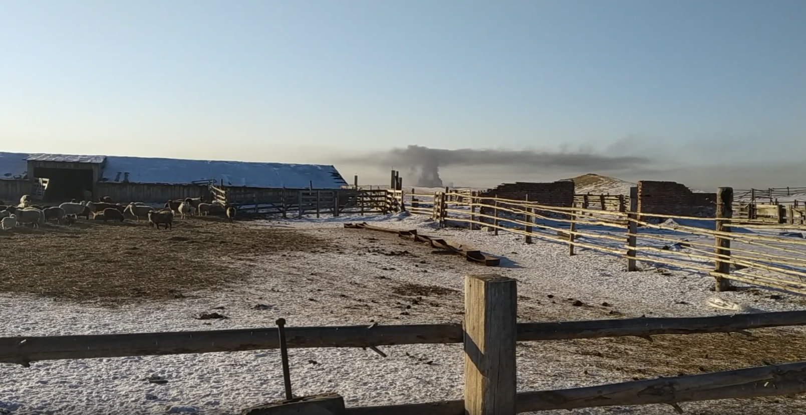
On 6 January 2020, I came here to film the “coal dragons”. The camera captured dark plumes over the industrial site and dust on the snow. But another change was taking place underground, one the camera could not show: the cones of depression created by two open-pit mines had already merged into a multi-kilometre area of lowered groundwater levels.
That day, a farmer named Denis showed us his farm. He had around three hundred sheep and several horses. He spoke not only about the dust and the land taken over by the mines. He said that water was becoming less available from wells and public standpipes.
At the time, this was the testimony of someone living next to coal mining. It can now be compared with state hydrogeological bulletins, project documents and monitoring results.
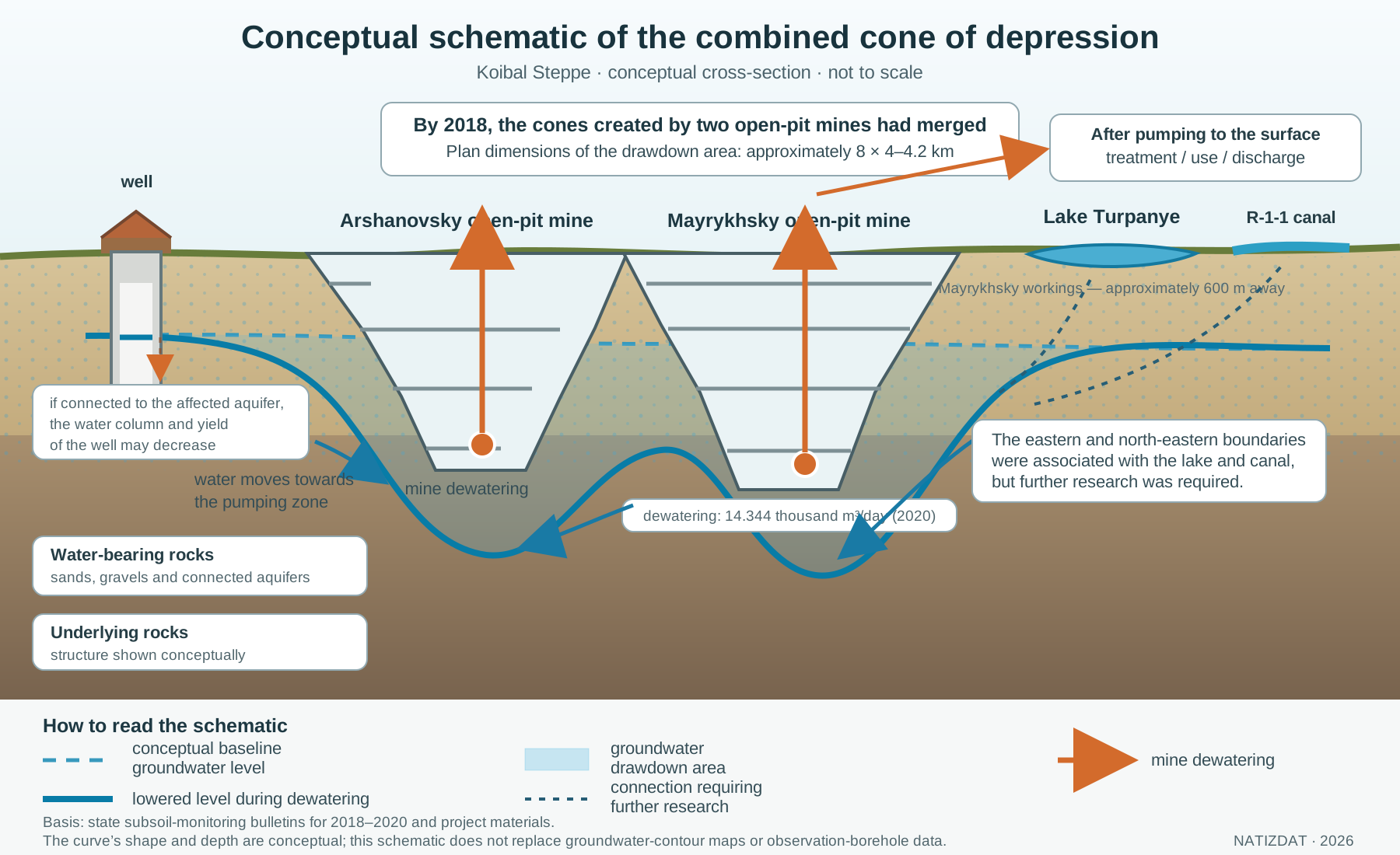
Such an area is called a cone of depression.
It does not look like a hole in the ground. It has no visible edge. But within it, water levels and directions of flow change. Water that could have fed shallow aquifers, lakes and wet depressions begins to move towards the mine, where pumps remove it.
An official state subsoil-monitoring bulletin reported that, by 2018 at the latest, the cones around two neighbouring open-pit mines — Arshanovsky and Mayrykhsky — had merged. Specialists could no longer distinguish their respective effects. The combined drawdown area extended for approximately eight kilometres from west to east and 4–4.2 kilometres from south to north.1
This investigation is an attempt to trace the path of the water: from the aquifer to mine dewatering, from treatment facilities to the discharge point, and from official figures to the wells, pastures and lakes of the Koibal Steppe.
 Enlarge ↗
Natalia Zubkova in the Koibal Steppe, 6 January 2020. Two plumes can be seen above the industrial site in the background.
What we established
- Mine dewatering at Mayrykhsky increased from 7.340 thousand cubic metres per day in 2017 to 14.344 thousand in 2020 — almost doubling.1
- The cones of depression around Mayrykhsky and Arshanovsky merged into a single groundwater drawdown area measuring approximately 8 × 4–4.2 kilometres.1
- In 2018, the known combined dewatering rate of the two mines was 20.481 thousand cubic metres per day — around 7.48 million cubic metres per year.1
- Mining at Mayrykhsky took place approximately 600 metres south-west of Lake Turpanye. Specialists associated the eastern and north-eastern boundaries of the cone with the lake and the R-1-1 canal, while also requiring further research to confirm that connection reliably.1
- State bulletins recorded changes in groundwater chemistry within the coal-mining area. In 2017, exceedances for iron, sodium, petroleum products, fluorides and mineralisation were recorded at Mayrykhsky; in 2018, arsenic was recorded at 1.5 times the maximum permissible concentration.12
- In 2022, the Government of Khakassia reported exceedances indicating inputs of phenols, sulphates, arsenic and fluorides into the Abakan River at the Mayrykhsky mine-water discharge point.3
- No continuous, publicly available record of water levels in the wells and boreholes of Arshanovo and Shalginov was found that would allow residents’ accounts to be compared with the development of the cone over time.
The final point does not negate the first six. It shows which observations should have accompanied such a major intervention in the steppe’s water regime, and which data must now be disclosed.
What is a cone of depression?
An open-pit mine intersects water-bearing rock. Unless the water is pumped out, it enters the workings and obstructs mining. Pumps keep the water level below the mine’s working horizon.
This creates an artificial gradient around the workings. Groundwater begins to move towards the area of lowered level. If points with the same water level around the mine are joined mentally, they form a concave surface — a cone of depression.
Its development is influenced by:
 Enlarge ↗
- the depth and area of the mine workings;
- the volume and duration of dewatering;
- the permeability of the rock;
- the presence of confining layers and faults;
- connections between different aquifers;
- recharge from precipitation, rivers, lakes and irrigation canals;
- dewatering at neighbouring operations.
At first, pumping draws a substantial share of the water from storage within the aquifer itself. As pumping continues, flow patterns change: the mine may intercept water that previously discharged into a river, lake or wet depression. The effects may appear after a delay and persist after the pumping regime changes. This mechanism is described in detail in hydrogeological reviews by the United States Geological Survey.4
A cone of depression is not a sinkhole. It is an area of lowered groundwater levels. It can exist without any visible crack or cavity at the surface. Land subsidence is a separate process: it can occur where lowering the water table causes compressible, water-saturated sediments to compact. The materials found for this investigation contain no measurements demonstrating that mine dewatering has already caused the surface of the Koibal Steppe to subside.
A cone is not established from an impression or from a single dry well. It requires observation boreholes, regular level measurements, ground-elevation data, information on filter depths, pumping volumes and a groundwater-contour map joining points of equal hydraulic head.
It was precisely such a state observation system that recorded the merger of the Mayrykhsky and Arshanovsky cones.
A steppe where water has always formed a system
The Koibal Steppe lies between the Abakan and Yenisei rivers. It is a dry-steppe landscape where most precipitation falls during the warmer months, and shallow groundwater is important to lakes, vegetation, pastures and agriculture.
The Mayrykhsky drying-complex project describes the northern part of the steppe as a valley of ancient channels of the Yenisei and Abakan containing numerous lakes. The largest, Lake Turpanye, is shallow and no more than three metres deep. The Okelkol network consists of around ten very shallow lakes in a shared valley approximately two kilometres long and 500 metres wide. According to the project materials, they received water from snowmelt, precipitation and high groundwater levels.5, PDF pp. 17–18
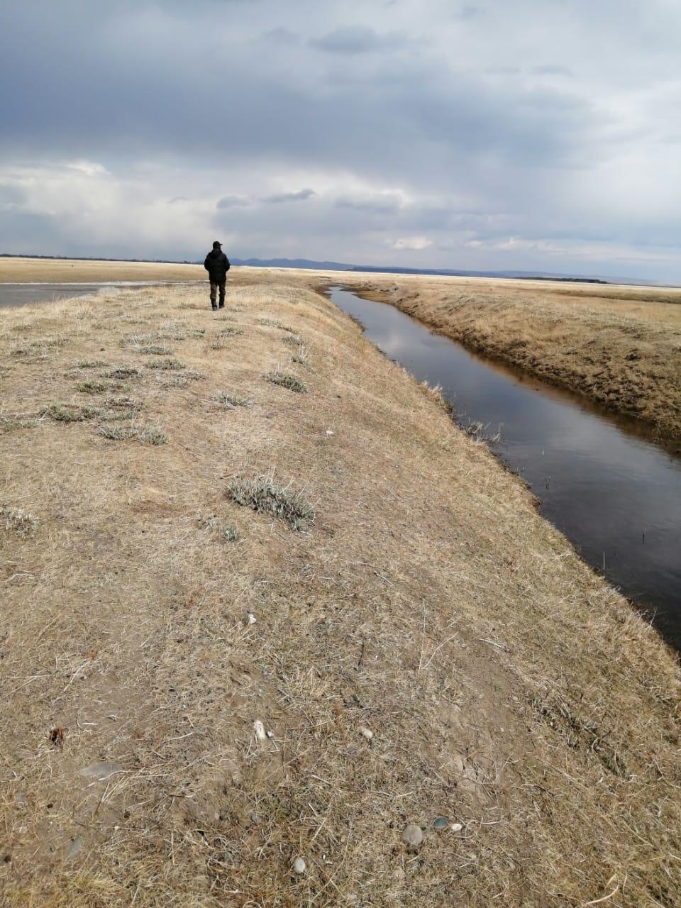
In this part of the steppe, the water table in the alluvial aquifer is generally within three to four metres of the ground surface. Its sands and gravels are highly permeable. The aquifer is recharged by precipitation, river floodwaters and, to a significant extent, seepage from irrigation canals. Water in the Lower Carboniferous deposits is hydraulically connected to the shallow groundwater.5, PDF pp. 20–21
 Enlarge ↗
This means that the mine, lake, canal and shallow borehole cannot be considered in isolation here. They may belong to the same connected water system.
Major changes predated the open-pit mines
Before modern coal mining, the Koibal Steppe was not an untouched hydrological wilderness.
A 2017 technical report by Minusinsky Hydrogeologist LLC, appended to the public-consultation materials, links a major change in the water regime to the development of irrigation. The Koibal Main Canal began operating in 1965. Water supply and seepage from the canals recharged the alluvial aquifer, raised groundwater levels and affected the lakes of the Sorokaozyorki tract.6, PDF pp. 82–96
The report presents long-term data from observation boreholes near Lakes Ptichye and Sobachye. At borehole No. 295 on the northern shore of Lake Ptichye, the average depth to water was 1.86 metres in 1969–1995 and 2.02 metres in 1995–2011. At borehole No. 101 west of Lake Sobachye, the average changed from 3.13 to 2.15 metres.6
These records show the central point: for decades, the steppe’s water depended not only on precipitation but also on the operation of the irrigation system. Intensive mine dewatering was subsequently added to this regime.
The right question, therefore, is not: “Was the steppe completely natural before the coal companies arrived?” The right question is: how did the new industrial pumping interact with the existing network of canals, lakes and aquifers — and who received the water after it was redistributed?
A historical parallel: Prokopyevsk, mines and falling well-water levels
The loss of local water supplies as coal mining developed has old precedents in Kuzbass.
A modern local-history retelling of Mikhail Nikitin and Georgy Vyatkin’s 1935 book The Pearl of Kuzbass reports that, before construction of the main water-supply system, Prokopyevsk obtained most of its water from wells: the small and polluted Aba River could not supply the rapidly growing town. When deep mine construction began in 1928, groundwater levels started to fall. Water levels in the wells fell.21
Urgent construction of a water main from the Tom River began in the summer of 1930. The work was delayed by shortages of equipment, while trenches left open over winter collapsed and had to be excavated again. The pipes were finally laid in 1933. In late autumn, the unfilled water-main trenches were at risk of freezing. According to the retelling, 17,000 workers from Prokopyevsk came out with shovels and filled the trenches in a single day.21
The water supply was not built in one day: the emergency task completed that day was backfilling the trenches over pipes that had already been laid. The electronic local-history database of the Kuzbass State Scientific Library separately confirms that centralised supplies of drinking water from the Tom began in Prokopyevsk in 1933 after construction was completed. The commissioned water-main branch was 36 kilometres long.22
The scan of the book itself was not examined for this edition, so the details of 1928–1933 are attributed here specifically to the historical retelling. The sequence of events is as follows: the development of deep mines was linked to falling groundwater levels; water levels in the wells fell; the former system of local water supply could no longer serve the rapidly growing town; water had to be brought from the Tom through a 36-kilometre main.
The Prokopyevsk episode is not a calculation for Khakassia and does not replace data from the Koibal Steppe. It is a historical parallel showing that coal mining changes more than the surface. Intervention in underground aquifers can deprive people of familiar sources of water. Remedying the consequences may require tens of kilometres of infrastructure and the labour of thousands of people.
Open-pit mines and water: a timeline
| Year | What happened | What it meant for water |
|---|---|---|
| 1965 | the Koibal Main Canal began operating | the irrigation network became an important source of recharge for groundwater and lakes |
| 1969–2011 | long-term observations were made in individual boreholes near Lakes Ptichye and Sobachye | a baseline existed showing the relationship between water levels, irrigation and climate |
| 1993 | according to the 2017 technical report, development of the Vostochno-Beisky site began | long-term industrial dewatering appeared in the steppe |
| 2015–2016 | the report dates the start of mining at the two large neighbouring open-pit mines to these years | dewatering at Arshanovsky and Mayrykhsky became a new factor in the water balance |
| 2017 | dewatering at Mayrykhsky was 7.340 thousand m³/day; exceedances of several groundwater parameters were recorded | this is the beginning of the numerical record available to us showing rapid growth in pumping |
| 2018 | dewatering at Mayrykhsky was 12.364 thousand m³/day; the cones of the two mines had already merged | the impact had become cumulative and specialists could no longer separate the contributions of the two operations |
| 2019 | dewatering was 13.656 thousand m³/day; the bulletin reported intensive drawdown | the drawdown area continued to develop |
| 2020 | dewatering was 14.344 thousand m³/day; the combined cone persisted | pumping at Mayrykhsky was almost twice the 2017 rate |
| 2021–2022 | regional monitoring reported inputs of several substances into the Abakan at the mine-water discharge point | the issue concerned not only quantity but also the quality of the returned water |
| 2023 | a state bulletin again described hydrochemical changes at coal-mining sites in Khakassia | the effects on groundwater continued to require observation |
| 2024 | at the “Beisky-Zapadny Open-Pit Mine Industrial Site (Arshanovsky-2 section)”, beryllium was recorded at 5.5, 4.5 and 4 times the MPC in different aquifer subdivisions | transparent, separate monitoring is required for every site and every borehole |
The final row concerns the “Beisky-Zapadny Open-Pit Mine Industrial Site (Arshanovsky-2 section)”, not Mayrykhsky. The three values — 5.5, 4.5 and 4 times the MPC — apply to different aquifer subdivisions at that site. They demonstrate the need for traceable data from the industrial area near Shalginov, but must not be transferred to other sites.7, PDF p. 104
How much water did Mayrykhsky pump out?
Official state subsoil-monitoring bulletins report the average daily volume of mine dewatering.1
| Year | Average dewatering, thousand m³/day | Calculated annual equivalent, million m³ |
|---|---|---|
| 2017 | 7.340 | 2.679 |
| 2018 | 12.364 | 4.513 |
| 2019 | 13.656 | 4.984 |
| 2020 | 14.344 | 5.250 |
The annual equivalents were calculated from the average daily dewatering rate and the number of calendar days. The calculation for 2020 uses 366 days: 14.344 thousand m³/day × 366 days = 5,249.904 thousand m³ ≈ 5.250 million m³. This is a calculation of scale, not a separate annual measurement.
Over four years, the average daily dewatering rate at Mayrykhsky increased by approximately 95 per cent.
In 2018, Arshanovsky pumped an additional 8.117 thousand cubic metres per day. The known combined dewatering rate of the two operations reached 20.481 thousand cubic metres per day — around 7.48 million cubic metres per year.1
The total dewatering figures in the sources used do not distinguish groundwater inflow from precipitation and surface runoff entering the workings.
To put the scale in context, this does not mean that the entire volume disappeared irretrievably from the region. Some of the pumped water is treated, used or discharged into surface watercourses. But once it has passed through the pumps, it no longer remains where and when it occurred under the natural water regime, or the regime that had developed before mining. Pumping changes the location, timing and direction of water movement and may also alter water quality.
The cones of two mines merged
The 2018 bulletin describes a combined drawdown area that had already formed:
- the cones at Arshanovsky and Mayrykhsky had merged;
- it was impossible to separate the effects of the two mine-dewatering systems;
- the combined cone extended approximately eight kilometres from west to east and 4–4.2 kilometres from south to north;
- the regional groundwater flow was directed towards the Abakan River;
- mining at Mayrykhsky was taking place approximately 600 metres south-west of Lake Turpanye.1, 2018 bulletin, PDF p. 74
Specialists tentatively associated the eastern and north-eastern boundaries of the cone with the waters of Lake Turpanye and the R-1-1 discharge canal. In the same document, they stated explicitly that further research and observation were needed to establish this connection reliably.1
The 2019 bulletin again gives the dimensions of the combined cone and states that the contributions of the two mines could not be separated. The most intensive impact was associated with the eastern part of Arshanovsky and the western part of Mayrykhsky. In the Mayrykhsky area, water levels were falling more rapidly than before because the mine was deepening and the working face was approaching the observation boreholes.1, 2019 bulletin, PDF pp. 71–74
In 2020, the combined cone persisted and dewatering at Mayrykhsky continued to increase.1, 2020 bulletin, PDF pp. 74–76
This is no longer a project forecast. It is the result of state observation of what happened underground.
Modelling of other large mining regions shows why cumulative impacts cannot be assessed from one operation or an average figure for an entire basin. In a study of the Mesabi iron-mining region, the United States Geological Survey found that local changes around mining sites could be substantially greater than the average result: water is removed in one place and returned to the system elsewhere.17 This is not a ready-made calculation for the Koibal Steppe, but a principle for constructing the model: all neighbouring mines, discharges and bodies of water must be considered at the same time.
Where did the pumped water go?
Lowering the water level is only the first half of the story. The second half begins after a pump brings the water to the surface.
The 2017 technical hydrogeological report stated that mine water from Arshanovsky was discharged directly into the Abakan, while water from Mayrykhsky passed through Lake Mayrykhkol and then also flowed towards the Abakan.6
Later project documentation describes mine-water treatment facilities. Surface runoff from the drying-complex site was to be collected and transported there for treatment.5, PDF pp. 33–34 and 63
In the broadest terms, the pathway is:
aquifer → open-pit mine → dewatering → treatment/use → discharge or storage pond → surface-water network
Every transition requires its own monitoring:
- how much water entered the mine;
- how much was pumped out;
- what share was used at the operation;
- what share went for treatment;
- how much was discharged and where;
- the composition before and after treatment;
- how the body of water and river changed upstream and downstream of the discharge.
Without this water balance, it is impossible to understand what share of the pumped water returned to the system and in what condition. No single, publicly available, long-term record answering all these questions for Mayrykhsky was found.
What happened to the chemical composition?
Water quantity and water quality are two different pathways of impact. An open-pit mine can lower the level while also changing chemical conditions in the rock.
When previously saturated minerals are drained, they come into contact with oxygen. Oxidation products may enter solution. When water later rises, they can dissolve and travel along new pathways. The 2023 state bulletin describes this mechanism directly for coal-mining sites in Khakassia and warns that contamination can persist for a long time after the workings refill.8, PDF pp. 139–141
What was recorded at Mayrykhsky
In 2017, the bulletin reported the following in groundwater at the site:2
- iron — 8 to 48 times the MPC;
- sodium — 1.3 to 3.2 times the MPC;
- petroleum products — 4.7 to 5.1 times the MPC;
- fluorides — 1.1 to 1.7 times the MPC;
- mineralisation — 1.2 to 1.8 times the MPC;
- in one borehole, nickel at 1.6 times the MPC and permanganate oxidisability at 2.6 times the MPC.
For water in the Lower Carboniferous deposits, exceedances were recorded for magnesium, sodium, fluorides, ammonium, oxidisability and mineralisation.2
In 2018, the state bulletin recorded arsenic at Mayrykhsky at 1.5 times the MPC.1
These are groundwater results from the mining area. They are not analyses of water from a particular tap in Arshanovo or Shalginov. Checking drinking-water sources requires the records for village boreholes, including the depth and screened interval, coordinates, analytical results and their relationship to the aquifer being monitored.
What was reported about the discharge into the Abakan
On 31 March 2022, the Government of Khakassia published the results of water-body monitoring for the fourth quarter of 2021 and the first quarter of 2022. In the Abakan River near the Mayrykhsky mine-water discharge, the authority reported exceedances of maximum permissible concentrations indicating inputs of pollutants at the discharge point for:3
- phenols;
- sulphates;
- arsenic;
- fluorides.
Concentrations of petroleum products, nitrates and nickel were above background levels but below the MPC.
The publication does not provide the concentrations themselves, coordinates, dates of each sample, methods or original laboratory reports. It therefore confirms a state authority’s report of contamination at the discharge point, but does not allow the exceedances to be recalculated independently or their duration to be reconstructed.
The original reports should be published or provided on request. Without them, the public can see the authority’s conclusion, but not the data on which it was based.
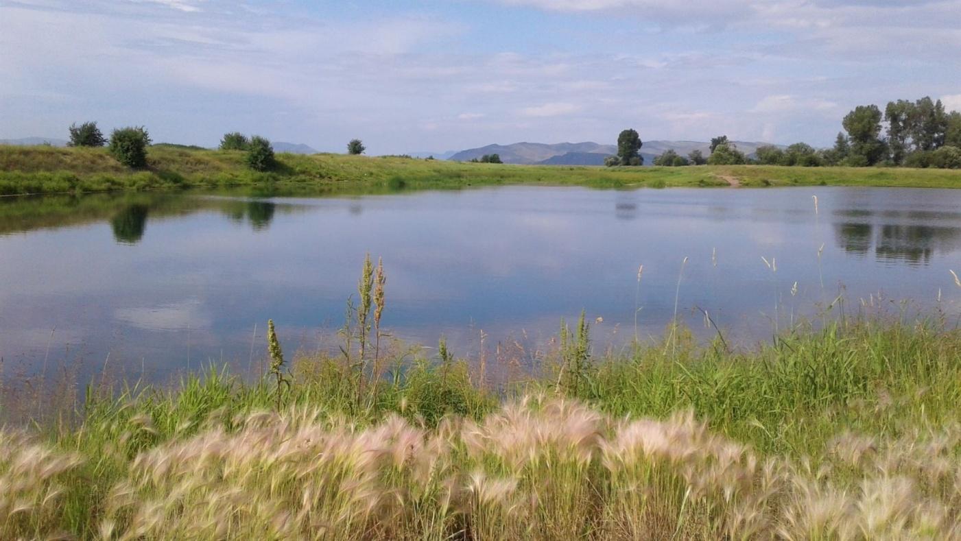
Lakes between the canal and the mine
The lakes of the Koibal Steppe depend on several sources at once: snowmelt, precipitation, surface runoff, the irrigation network and groundwater. The drying of an individual body of water therefore cannot be attributed to a single cause without a water balance.
But the documents show why the question of the mines’ impact cannot be set aside.
 Enlarge ↗
The Okelkol network was supplied partly by high groundwater levels. The project notes that the lakes dry out seasonally. During surveys conducted between November 2018 and January 2021, there was no water in the lakes.5, PDF p. 17
This fact alone does not identify a single cause. It does, however, fall within the period when the combined cone of two mines and increasing dewatering were officially being recorded. Answering the question requires simultaneous records of:
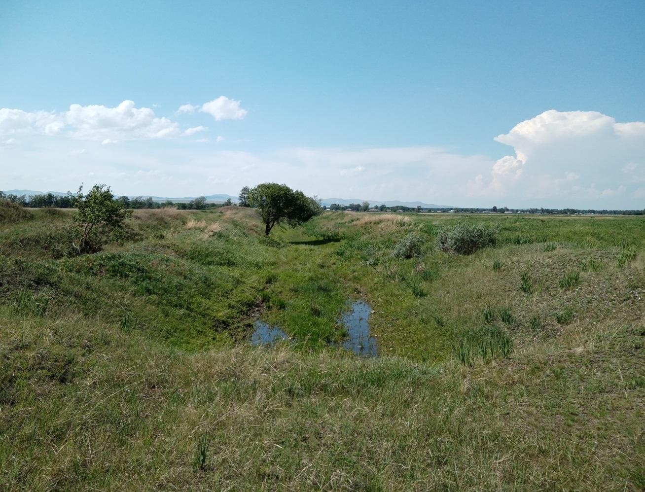
- water supplied through the irrigation canals;
- precipitation and evaporation;
- lake levels;
- levels in observation boreholes;
- mine dewatering and discharge;
- the position of the mining face.
As early as 2017, hydrogeologists warned that the development of the cones could affect the lakes, and that the future of the water system would depend both on the operation of the Koibal irrigation network and on the volume and location of mine-water discharge. They proposed centralised treatment, long-term observation of water levels and quality, and continuous hydrogeological supervision.6
This was not abstract environmental advice. It was a list of the data without which the connected “canal — groundwater — lakes — mine — river” system cannot be managed.
 Enlarge ↗
What residents said
On 6 January 2020, Denis told us that water was becoming less available from wells and public standpipes. His account came alongside other changes: shrinking pastures, the expansion of industrial land, and dust on people and animals.9
This testimony cannot be replaced by a table in a state bulletin. But neither should the table disappear behind the testimony. They answer different questions.
State monitoring confirms that a combined cone spanning several kilometres formed beneath the industrial area and that dewatering was increasing rapidly. Denis describes how the change in water was experienced in the daily life of a farm.
 Enlarge ↗
To test the connection for a particular well or public standpipe, the state and the company should have retained data allowing the following to be compared:
- the source’s design and depth;
- water levels by date;
- the aquifer;
- distance from the mine workings;
- development of the cone of depression;
- the dewatering regime;
- operation of the irrigation canals and the dryness of the year.
No such publicly available record was found for Arshanovo and Shalginov.
This does not mean that water levels “did not fall”. It means that state and industrial monitoring systems did not provide residents with an accessible answer about what was happening to their water sources.
What the cone threatens in the steppe
1. Wells and shallow boreholes
If a source is connected to an aquifer in which the level is falling, the water recedes to a greater depth. The available water column and yield decrease. A pump must be lowered, and a borehole deepened or replaced. For a farm, this means additional costs and the risk of being left without water when it is needed most.
2. Lakes and wet depressions
Where a lake receives part of its supply from groundwater, lowering the level can reduce groundwater inflow or change its direction. In an arid steppe, even a small reduction in recharge is especially noticeable in dry years.
3. Pastures and vegetation
Not all steppe vegetation depends on shallow groundwater. But shoreline communities, wet depressions, areas along canals and plants with access to a shallow aquifer are sensitive to its decline. The drying-complex project itself acknowledges that disruption of the hydrogeological regime can cause one plant community to be replaced by another.5, PDF p. 35
For livestock farming, the area of land shown on a cadastral map is not the only thing that matters. Water, grassland productivity and access to watering places matter too. A drained or depleted plot may formally remain pasture while becoming less able to fulfil that function.
4. Dust from dried surfaces
When wet depressions and shores lose water, soil and fine sediment dry out and are dispersed more easily. The effect on water can therefore increase the dust burden — not only from machinery, waste dumps and coal processing, but also from newly exposed surfaces.
 Enlarge ↗
5. Transport of dissolved substances
A cone changes the hydraulic gradient. Water begins to move in new directions and may be drawn in from neighbouring aquifers. At the same time, drainage and refilling of rock alter chemical reactions. Monitoring must therefore cover not only water levels but also water composition.
6. Effects after the pumps stop
Stopping dewatering does not instantly return the system to its previous state. Water levels begin to recover, workings fill and flow directions change. Water comes into contact with oxidised rock and may carry iron, sulphates and other constituents.
Can the steppe be restored after coal mining?
Restoring the surface and restoring the water system are not the same thing.
Waste dumps can be regraded, fertile soil placed on top and grass sown. But if a water deficit remains beneath the land, connections between aquifers have changed or contaminated discharges continue, the landscape has not been returned to a stable condition.
After pumping stops, groundwater usually begins to rise. But the rate and final level depend on the geology, the size of the workings, water inflow and connections to surface waters. Recovery may take years or decades. It can replenish water resources, but may also create new problems: flooding, the emergence of mineralised mine water, river pollution, unstable pit slopes and changing water levels in settlements.
A real example: Lusatia, Germany
In the lignite-mining regions of Lusatia and Central Germany, long-term pumping created an enormous groundwater deficit. After the mines closed, water levels began to recover and the pits began to become lakes. The German company LMBV manages flooding, treats water, runs models and regulates levels. According to an LMBV statement of 22 September 2025, around 6.4 billion of an estimated 7 billion cubic metres of mining-related water deficit had been replenished in Lusatia, but work on the remaining deficit, water quality and flood risks continues.10
This example is not a forecast for Khakassia. Its lesson is different: recovery after large-scale mine dewatering is a water-management project in its own right, lasting many years. It requires a model, target levels, external and internal water balances, treatment, safe discharges and post-closure monitoring.
Section H2.4 of SEPA’s 2009 groundwater-protection policy provides for open-cast coal operations to assess the subsequent rise in groundwater, its predicted quality, where it will emerge into surface waters and how effective protective measures will be.11
For the Koibal Steppe, this means that a reclamation plan must answer more than how the workings will be filled and what grass will be sown. It must show:
- how and when dewatering will be reduced;
- the elevations to which groundwater will recover;
- what will happen to the combined cone;
- how Turpanye, Okelkol, Mayrykhkol, the canals and the Abakan will change;
- the composition of the water as the workings fill;
- where that water may emerge;
- how many years monitoring will continue;
- who will pay for treatment and remediation after mining ends.
Who is responsible for knowing where the water went?
Residents should not have to build their own hydrogeological observation network around open-pit mines.
Responsibilities are divided among several parties.
The company
A subsoil user must monitor the condition of the subsoil within its licensed area, conduct industrial environmental monitoring and keep records of the impacts of its activities.1213
A water user must account for the volume of water abstracted and of wastewater discharged, including drainage water, monitor its quality and regularly observe the body of water and its protection zone within the applicable requirements.14
The company should possess the original data on pump operation, dewatering, observation boreholes, treatment and discharges. Publication of a few annual averages is not a substitute for the complete record.
State subsoil monitoring
The federal monitoring system is required to observe the condition of groundwater and to store and analyse information about changes. Its bulletins were what made it possible to establish the merger of the cones and the increase in dewatering.12
But a summary bulletin is not a substitute for access to the original measurements: borehole coordinates, water-level elevations, screened intervals, sampling dates and analytical results.
Water and environmental regulators
Within their powers, they oversee compliance with water-use conditions, treatment and discharge, receive reports and carry out inspections. If monitoring reported inputs of pollutants into the Abakan, the reports on which that conclusion was based and information on subsequent measures should be available.
Public-health authorities and local government
Rospotrebnadzor and water-supply organisations are responsible, within their powers, for monitoring the safety of drinking water. Municipal and regional authorities hold information about rural water sources, emergencies, deliveries of drinking water and residents’ complaints.
Medical and personal data must be anonymised, but the results of monitoring drinking-water sources and the condition of water-supply systems must not disappear from public view.
The right to know
Article 42 of the Russian Constitution guarantees everyone the right to reliable information about the state of the environment.15
Article 4.3 of the Federal Law On Environmental Protection classifies information on the state and pollution of the environment, the effects of economic activity and environmental-protection measures as environmental information and establishes its public accessibility.16
This provision was introduced in 2021, so it cannot be applied retrospectively as proof of a violation in 2019–2020. But today it directly supports the demand to disclose the environmental information that exists.
The central question to the company and public authorities is this:
These data were not found in the public domain. Information on environmental pollution and emissions is environmental information to which access must be ensured. It is necessary to establish whether measurements were made, who holds the results and how residents can obtain them. If the necessary measurements were not made, a separate question arises: who was responsible for conducting them, and why were they not carried out?
We cannot assume in advance that no measurements were made: the absence of publication and the absence of measurement are different facts. But closed data cannot be used as evidence of safety either.
What must be published
Assessing the effects of the open-pit mines on the waters of the Koibal Steppe requires existing primary data, not new promises:
- Coordinates, absolute elevations, depths and screened intervals for all observation boreholes at Mayrykhsky and Arshanovsky.
- Monthly groundwater levels for every borehole from the beginning of observations.
- Annual groundwater-contour maps and boundaries of the cone of depression, not merely brief narrative descriptions.
- Daily and monthly dewatering volumes for each mine, together with pump operation and shutdowns.
- A complete water balance: pumping, use, evaporation, storage, treatment and discharge.
- Permits and conditions for mine-water discharges, the coordinates of discharge points and actual volumes.
- Original laboratory reports for water before and after treatment and upstream and downstream of discharges.
- Long-term levels in Lakes Turpanye and Mayrykhkol and the Okelkol system, together with the water-supply regime of the canals.
- Records and water levels for rural boreholes and wells, together with records of water availability from public standpipes in Arshanovo and Shalginov.
- Drinking-water monitoring results for each source.
- A hydrogeological model of the cumulative effects of all neighbouring open-pit mines.
- A plan for reducing dewatering, flooding the workings and post-closure monitoring.
Some of these materials should be held by the company, some by the state subsoil-monitoring system, and some by water, environmental and public-health regulators. The holder of each dataset must be identified and residents must be given access to it.
What we can already say without speculation
The cone of depression beneath the Koibal Steppe is not imaginary; it has been officially recorded.
It was formed by the combined effects of at least two open-pit mines. By 2018, their cones had merged and specialists could no longer separate the contributions of the two operations. Dewatering at Mayrykhsky continued to increase and by 2020 was almost twice the 2017 rate.
Changes in groundwater chemistry were recorded in the coal-mining area. At the mine-water discharge into the Abakan, state monitoring reported inputs of phenols, sulphates, arsenic and fluorides.
Even before the mines, the steppe water system depended on canals and irrigation. Coal mining did not create this system, but inserted a powerful new pump into it, redistributing millions of cubic metres of water every year.
The published data do not yet allow us to state by how many centimetres Mayrykhsky itself lowered the water in Denis’s particular well, or what share of its recharge a particular lake lost. But this is not because there is nothing to investigate. It is because the original records have not been made public in a place where industrial impacts were already being measured by the state and the company.
Sources and documents
Numbers in the text link to the corresponding entry. Site documents and external sources open in a new tab.
- Siberian Regional Centre for State Subsoil Monitoring, a branch of Gidrospetsgeologiya. Information bulletins on the state of the geological environment in the Siberian Federal District: 2018, PDF pp. 73–76; 2019, PDF pp. 71–74; 2020, PDF pp. 74–76 and 105–106. The combined cone of depression, dewatering and groundwater levels.↩
- Ibid. 2017 bulletin, PDF p. 68. Hydrochemical parameters of groundwater at Mayrykhsky.↩
- Government of the Republic of Khakassia. Results of water-body monitoring for the fourth quarter of 2021 and first quarter of 2022, 31 March 2022.↩
- Barlow P. M., Leake S. A. Streamflow Depletion by Wells—Understanding and Managing the Effects of Groundwater Pumping on Streamflow. USGS Circular 1376, 2012.↩
- Sibgiproruda JSC. Environmental impact assessment for the long-flame coal drying complex of Mayrykhsky Open-Pit Mine Coal Company LLC, 2021: landform and lakes — PDF pp. 17–18; hydrogeological conditions — PDF pp. 20–21; water-impact assessment — PDF pp. 33–35; industrial monitoring — PDF pp. 56–57.↩
- Minusinsky Hydrogeologist LLC. Report on the hydrological and hydrogeological survey of bodies of water in the Sorokaozyorki tract, Beysky and Altaisky districts of the Republic of Khakassia. Stage III, 2017. Included in Volume 3 of the EIA for Project
390-909-19, PDF pp. 82–96.↩ - Siberian Regional Centre for State Subsoil Monitoring, a branch of Gidrospetsgeologiya. Information Bulletin on the State of the Subsoil in the Siberian Federal District in 2024. Book 1, Table 1.15, PDF p. 104.↩
- Siberian Regional Centre for State Subsoil Monitoring, a branch of Gidrospetsgeologiya. Information Bulletin on the State of the Subsoil in the Siberian Federal District in 2023. Book 1, PDF pp. 138–141.↩
- Natalia Zubkova’s archive. Original video recordings from the filming trip of 6 January 2020; video Dragons of Khakassia, published on the Tiblok1 channel on 2 February 2020.↩
- Lausitzer und Mitteldeutsche Bergbau-Verwaltungsgesellschaft. Mine Water Management, Groundwater Recovery and its statement of 22 September 2025, The Lusatia Flooding Centre Marks a Quarter of a Century — Changed Responsibilities and Renaming as WBLR. Data on restoring the water balance and managing groundwater recovery in Lusatia and Central Germany.↩
- Scottish Environment Protection Agency. Groundwater Protection Policy for Scotland and Mineral Extraction Code of Practice. Requirements for assessing groundwater recovery and quality after dewatering ends.↩
- Law of the Russian Federation No. 2395-1 of 21 February 1992, On Subsoil. Article 36.2. State monitoring of the condition of the subsoil and monitoring within the licensed area.↩
- Federal Law No. 7-FZ of 10 January 2002, On Environmental Protection. Article 67. Industrial environmental monitoring.↩
- Water Code of the Russian Federation. Article 39. Rights and obligations of water users; Article 55. Basic requirements for the protection of bodies of water; Article 60. Protection of bodies of water in the design and operation of economic facilities.↩
- Constitution of the Russian Federation. Article 42.↩
- Federal Law No. 7-FZ of 10 January 2002, On Environmental Protection. Article 4.3. Information on the state of the environment.↩
- Cowdery T. K., Baker A. C., Haserodt M. J., Feinstein D. T., Hunt R. J. Hydrologic Change in the St. Louis River Basin from Iron Mining on the Mesabi Iron Range, Northeastern Minnesota. U.S. Geological Survey Scientific Investigations Report 2022–5124, 2023. Used as a methodological example of assessing the cumulative hydrological effects of mining, not as a calculation for Khakassia.↩
- Geld T. A., Zlotnikova T. V. The Current State of the Avifauna of the Wetland Ecosystems of the Sorokaozyorki Tract (Minusinsk Basin, Koibal Steppe). Modern Problems of Science and Education. 2015. No. 5. More than 100 bird species, including 28 species listed in Red Data Books at various levels; the tract’s importance for breeding rare species; Sorokaozyorki’s inclusion on the shadow, or prospective, list under the Ramsar Convention.↩
- Directorate for Specially Protected Natural Areas of the Republic of Khakassia. Lakes of the Koibal Steppe Regional Wildlife Sanctuary. The sanctuary’s boundaries, lakes, vegetation, birds and mammals.↩
- N. F. Katanov Khakass State University, Institute of Natural Sciences and Mathematics. The Department of Biology Developed the Project for and Helped Establish the Lakes of the Koibal Steppe Regional Wildlife Sanctuary, 7 November 2020. Composition of the territory and the statement that Lakes Ptichye, Sobachye and Zalivnoye lay outside the land allotments of coal-mining companies when the sanctuary was established.↩
- VSE42.RU. History and Public-Utility Tariffs in Kuzbass. Chapter Two: Kemerovo and the Region. A local-history retelling of a passage from M. A. Nikitin and G. A. Vyatkin’s 1935 book The Pearl of Kuzbass, concerning falling groundwater levels, falling well-water levels and construction of the Prokopyevsk water main. The scan of the book was not used in preparing this edition.↩
- V. D. Fyodorov Kuzbass State Scientific Library. 1933: Vodokanal Established in Prokopyevsk. Confirmation that centralised supplies of drinking water from the Tom River began in Prokopyevsk in 1933.↩
- Conservation of the Biodiversity of the Koibal Steppe project. Report on the Conservation of the Biodiversity of the Koibal Steppe Project. Abakan, 2020. The report lists the project team and the authors of the photographs.↩